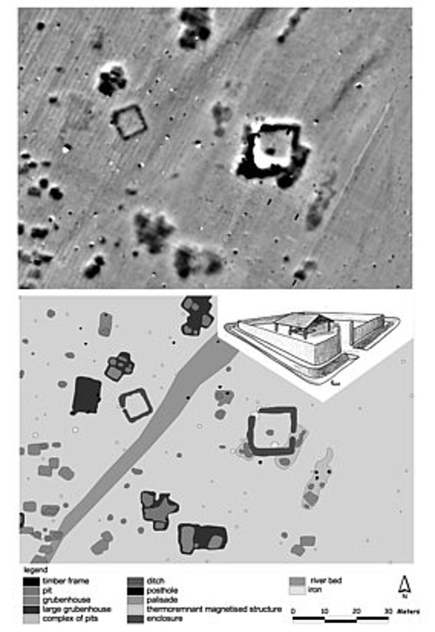
GIS based integrated interpretation
For the integrated interpretation of archaeological prospection data VIAS uses Geographical Information Systems (GIS) since 1993. After processing and visualization of geophysical data the georeferenced information is combined with additional data from aerial archaeology (orthophotos, DTM, archaeological interpretation), field surveys, historical maps, excavations and further geographical data for an integrated thematic archaeological interpretation in a GIS.
Recent research is focused on the development of specific GIS tools for spatial analysis of archaeological prospection data.