The search for the Avar settlement

The cemetery of Frohsdorf with 501 burials suggest the existence of a nearby settlement where the people who occupied this cemetery lived.
Some Avar settlements are known, for example, in Hungary, only a few of them excavated and published. In Austria such settlements are still largely unknown. Only those of Zillingtal (Bgld.) was excavated partly, a publication is pending.
It was tried to locate the burial site of Frohsdorf associated settlement by aerial prospection and field survey within a radius of 5 km - so far unsuccessfully.
However, the deserted medieval village Mitterndorf was located by archaeological prospection as a "by-product".
The deserted village of Mitterndorf
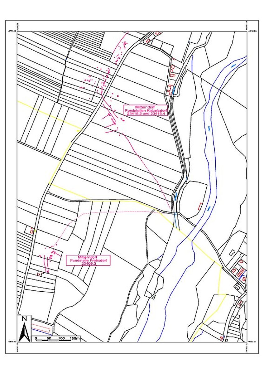
In the areas of Frohsdorf and Katzelsdorf two sites of medieval deserted villages were located. They show the typical pattern of deserted sites with property or building features lying along a road .
Due to their location and dating these sites are to be identified by in written sources repeatedly mentioned settlement Mitterndorf with high probability. The majority of the high medieval finds comes from the site Mitterndorf I, much less could be dated as late medieval here. On the site Mitterndorf II, however, only a few pottery fragments could be dated to the high medieval period, most finds here are late medieval. Thus, the settlement site Mitterndorf I is probably to be dated high medieval. The spatial extent of this site is significantly lower than that of Mitterndorf II. This situation approaches the Miterendorf 1260/80 mentioned in a princely land register, which is said to have consisted of four farms. The site Mitterndorf II, however, due to the archaeological finds could be dated as late medieval.
Regarding the two sites in a spatial context it should be noted that they are in a conventional distance to the town centers of today's settlements north (Katzelsdorf) and south (Kleinwolkersdorf and Frohsdorf) thereof. The two sites Mitterndorf whose centers are located about 740 m apart, however, are located too close to each other.
Due to the aerial photographs, finds from the field survey and written sources there was a hypothesis developed:
Both settlements are referred to in written sources mentioned village Mitterndorf. Due to the different dating there could be a case of local relocation. The later settlement Mitterndorf II is slightly higher than Mitterndorf I. Because of the close flowing river Leitha and the resulting flooding Mitterndorf I has been possibly given up in the 13th century and moved to the higher settlement site Mitterndorf II. The deserting of Mitterndorf I would therefore have natural, environmental reasons. The deserting of Mitterndorf II could – due to the time allocation of the written sources and surface finds – communicate with the Turkish wars of the 16th century. However, even in the event of a deserting of Mitterndorf II in the 15th century natural reasons because of its location in the transitional zone between flooding and non flooding area and low- to mid-quality farmland are conceivable.

