Discovery of Swedish King Karl XII's galley way from 1718
The Vienna Institute for Archaeological Science (VIAS) is pleased to announce a significant technological advancement and breakthrough in historical research achieved through collaborative efforts and innovative geoarchaeological prospection technology. In December 2024, a team of scientists, including experts of the Norwegian Institute for Cultural Heritage Research (NIKU), the Swedish "Archaeologists", Bohusläns Museum, and VIAS, successfully conducted large-scale high-resolution autonomous georadar measurements near Strömstad in Sweden. While the initial plan had been to search for Iron Age burials in the vicinity of Grönhög burial mound close to the prehistoric cemetery of Blomsholm, due to wet ground conditions there the survey was shifted towards the location of the Iron Age stone ship of Blomsholm.
Three days of georadar survey using an innovative autonomous georadar system resulted in the discovery of traces of Sweden’s King Karl XII’s "Galärvägen" – the overland route between Strömstad and Idefjord, which had been used to transport twelve large naval galleys during the 1718 military campaign against Norway. Some 800 soldiers hauled the up to 20 m long and up to 30 tons heavy ships over the course of four months across the 25 km long route.
This remarkable discovery was made possible by deploying the AutoMIRA system, an autonomous ground-penetrating radar (GPR) technology setup at NIKU. The project was headed by archaeologist Erich Nau from NIKU, with VIAS contributing both to the initial concept and by providing financial support. The Blomsholm area near Strömstad in Bohuslän, Sweden, is known for its rich cultural heritage, which includes Sweden's second-largest stone ship and several burial mounds. The GPR survey revealed parallel linear structures in the ground, corresponding to the historical Galärvägen, thereby providing new insights into one of Sweden's most fascinating military operations.
The success of this project underscores the importance of interdisciplinary collaboration and the application of latest technology in archaeological research. The deployment of the AutoMIRA system, an autonomous GPR technology developed through a partnership between NIKU, AutoAgri AS, and Guideline Geo/MALÅ, has demonstrated significant advancements in non-invasive archaeological surveying. This technology enables efficient and precise mapping of subsurface structures, minimizing environmental impact and preserving the integrity of cultural heritage sites. The initial concept for autonomous georadar surveys was pioneered by a team of scientists at the former Ludwig Boltzmann Institute for Archaeological Prospection and Virtual Archaeology in Vienna, including the experts from NIKU, GeoSphere Austria, and VIAS. Their innovative work laid the foundation for the development of advanced autonomous systems like AutoMIRA, which is opening up for new possibilities in the field of geoarchaeological prospection.
More information can be found on NIKU’s web pages.
Impressions
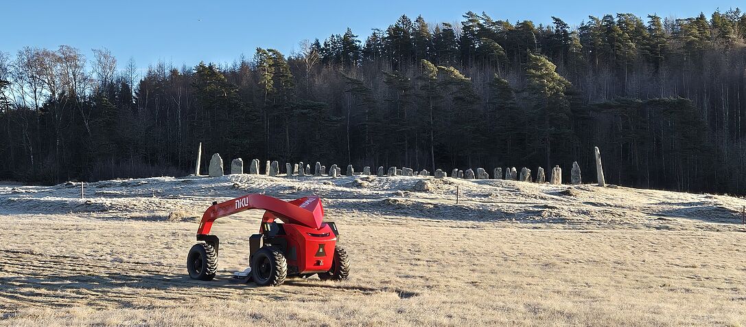
The autonomous AutoMIRA georadar system in front of Blomsholm stone ship.

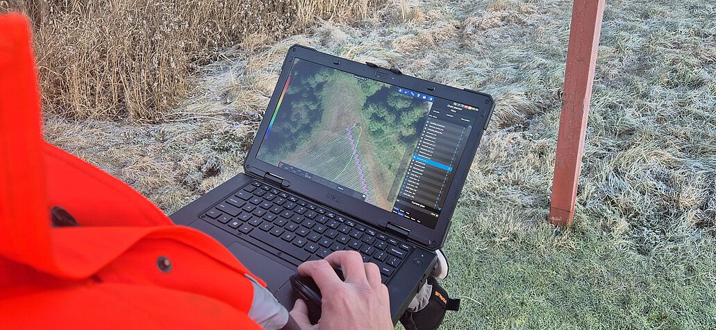
Archaeologist Erich Nau defining the survey geometry online.
Parallel survey swath layout for optimal site coverage.
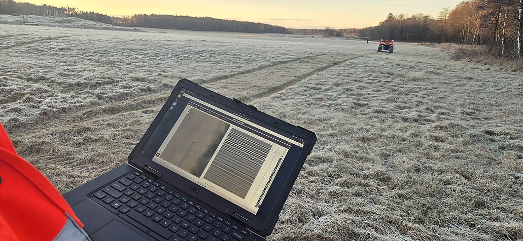
Realtime quality control in the field of the collected georadar data.
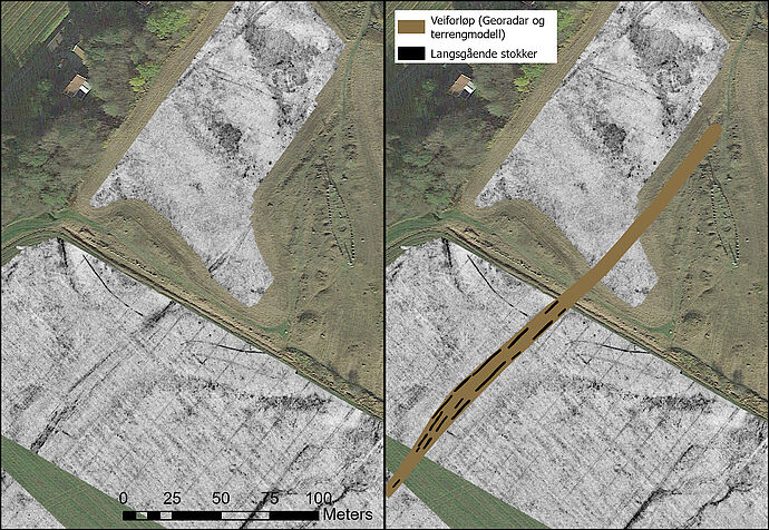
Georadar data slices and interpretation, showin the galley way (brown) and the buried timbers (black).
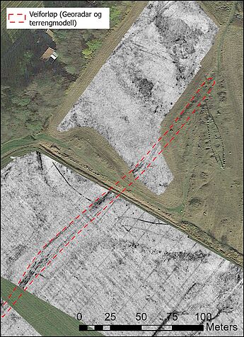
Outline of the galley way in red.